


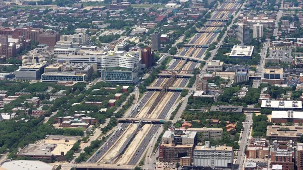
UIC architecture students competed to design improvements for the spaces under Chicago's South Side "Skyway," which carries drivers from the city to and from Northwest Indiana.
Underpasses on Chicago's South Side were the subject of a University of Illinois at Chicago contest for architecture students. Chicago's Skyway is a privately owned highway that connects northwest Indiana and Chicago. The South Chicago Chamber of Commerce and architecture firm, Urban Labs, put together an exhibition of the student's concepts.
"The purpose of last week’s meeting was to gather feedback from the community on what they would like to see occupy the 93rd and Commercial space," Maribel Quezada writes for Streetsblog Chicago.
In many of the proposals, little-loved spaces would turn into places to walk, bike or relax, enlivening the neighborhood the Skyway passes through on the southeast side of Chicago. "Under this proposal, the space would be transformed into a unique, recognizable public space that would attract and benefit multiple generations through the use of art, a garden-market, and play spaces," Quezada writes.
FULL STORY: South Chicagoans Weigh in on Plans to Activate Dead Space Under the Skyway

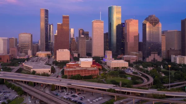
Reimagining the Space Beneath Houston’s Freeways
Opportunities abound for Houston to capitalize on otherwise unused space beneath its wide network of freeways.
Chicago Awarded $2M Reconnecting Communities Grant
Community advocates say the city’s plan may not do enough to reverse the negative impacts of a major expressway.

Chicago's Lake Shore Drive Renamed to Honor Black Pioneer
Introducing Jean Baptiste Point DuSable Lake Shore Drive, renamed to honor the first non-indigenous settler of Chicago.

National Parks Layoffs Will Cause Communities to Lose Billions
Thousands of essential park workers were laid off this week, just before the busy spring break season.

Retro-silient?: America’s First “Eco-burb,” The Woodlands Turns 50
A master-planned community north of Houston offers lessons on green infrastructure and resilient design, but falls short of its founder’s lofty affordability and walkability goals.

Delivering for America Plan Will Downgrade Mail Service in at Least 49.5 Percent of Zip Codes
Republican and Democrat lawmakers criticize the plan for its disproportionate negative impact on rural communities.

Test News Post 1
This is a summary

Test News Headline 46
Test for the image on the front page.

Balancing Bombs and Butterflies: How the National Guard Protects a Rare Species
The National Guard at Fort Indiantown Gap uses GIS technology and land management strategies to balance military training with conservation efforts, ensuring the survival of the rare eastern regal fritillary butterfly.
Urban Design for Planners 1: Software Tools
This six-course series explores essential urban design concepts using open source software and equips planners with the tools they need to participate fully in the urban design process.
Planning for Universal Design
Learn the tools for implementing Universal Design in planning regulations.
EMC Planning Group, Inc.
Planetizen
Planetizen
Mpact (formerly Rail~Volution)
Great Falls Development Authority, Inc.
HUDs Office of Policy Development and Research
NYU Wagner Graduate School of Public Service