


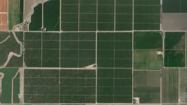
A massive data visualization project illuminates the land uses that define the United States.

Dave Merrill and Lauren Leatherby share a new data visualization project that illustrates the land uses of the 48 contiguous United States, "a 1.9 billion-acre jigsaw puzzle of cities, farms, forests and pastures that Americans use to feed themselves, power their economy and extract value for business and pleasure."
The mapping project started by collecting data from the U.S. Department of Agriculture that divides the United States into six major types of land use: pasture/range, forest, cropland, special use, miscellaneous, and urban. Configuring that data into squares representing 250,000 square acres of land provides perspective on how land is used in the country as a whole. Further levels of distinction provide additional perspective—for agriculture, for instance:
…the actual land area used to grow the food Americans eat is much smaller—only about the size of Indiana, Illinois and half of Iowa combined. More than a third of the entire corn crop is devoted to ethanol production. Most cropland is used for livestock feed, exports or is left idle to let the land recover.
For those keeping track at home, the most dominant land use in the country is devoted to pasture, and the federal government administers 25 percent of that land. "Between pastures and cropland used to produce feed, 41 percent of U.S. land in the contiguous states revolves around livestock," according to the article.
FULL STORY: Here's How America Uses Its Land


How the National Park Service Uses GIS
A new book demonstrates how the National Park Service uses GIS technology to meet its mission and showcases a selection of maps used for effectively managing national parks.

New Tool Puts Miami Development Opportunities on the Map
There's plenty of vacant or underutilized land to be found in Miami-Dade County, if you know where and how to look.
Facebook AI Maps Population Density
Facebook expects to release its worldwide maps of human density in the coming months—potential applications will likely be somewhere on the spectrum between humanitarian and commercial.

Analysis: Cybertruck Fatality Rate Far Exceeds That of Ford Pinto
The Tesla Cybertruck was recalled seven times last year.

National Parks Layoffs Will Cause Communities to Lose Billions
Thousands of essential park workers were laid off this week, just before the busy spring break season.

Retro-silient?: America’s First “Eco-burb,” The Woodlands Turns 50
A master-planned community north of Houston offers lessons on green infrastructure and resilient design, but falls short of its founder’s lofty affordability and walkability goals.

Test News Post 1
This is a summary

Analysis: Cybertruck Fatality Rate Far Exceeds That of Ford Pinto
The Tesla Cybertruck was recalled seven times last year.

Test News Headline 46
Test for the image on the front page.
Urban Design for Planners 1: Software Tools
This six-course series explores essential urban design concepts using open source software and equips planners with the tools they need to participate fully in the urban design process.
Planning for Universal Design
Learn the tools for implementing Universal Design in planning regulations.
EMC Planning Group, Inc.
Planetizen
Planetizen
Mpact (formerly Rail~Volution)
Great Falls Development Authority, Inc.
HUDs Office of Policy Development and Research
NYU Wagner Graduate School of Public Service