


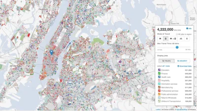
Designed by researchers at the University of Chicago, the Plenario platform gathers all available open data for a specific area. Then it presents the data in an easy-to-use format.
The push for open data publication means very little if researchers can't actually use the data in accessible and meaningful ways. Useful insights often require putting local data into context with information from different places or different times. But in their raw form, datasets are often too specific to easily serve that purpose.
Plenario, a data platform currently in its alpha stage, intends to solve that problem for urban researchers. "With one query, users can access, combine, download and visualize disparate sets of data all in the same place [...] Plenario utilizes Amazon Web Services, a cloud-computing platform, as its scalable back-end infrastructure, which means that storage and computing power for more data sets is not a concern."
University of Chicago's Urban Center for Computation and Design (UrbanCCD) created and launched Plenario late last year. Users specify the neighborhoods or areas they wish to study by drawing a polygon on a map. The platform then delivers a summary of all the datasets available for that area, with links to the sets themselves.
Plenario is open to outside input, allowing users to "upload any publicly available URL for a data source that is either a Socrata or CKAN data set or in CSV format, so long as the data includes the fundamental dimensions of time and location."
FULL STORY: University of Chicago’s 'Plenario' Changes How We Use Open Data

New Center Seeks to Take the Guesswork out of Planning
Researchers at the University of Chicago are tackling a problem that is confronting the globe's biggest cities: how to turn the reams of data being collected and opened to the public and turn it into actionable information for decision-makers.

Next on the List for Data Startups: Managing Curb Space
The humble curb is getting crowded: not only with new modes of transportation, but also with a slew of new data tools aiming to keep track of it all.
Tracking Chicago’s Potholes
A new animated map presents the reported cases of potholes in Chicago since November—the maps colorful and provides insights into how the city, and our relationship to it, can change with time.

National Parks Layoffs Will Cause Communities to Lose Billions
Thousands of essential park workers were laid off this week, just before the busy spring break season.

Retro-silient?: America’s First “Eco-burb,” The Woodlands Turns 50
A master-planned community north of Houston offers lessons on green infrastructure and resilient design, but falls short of its founder’s lofty affordability and walkability goals.

Delivering for America Plan Will Downgrade Mail Service in at Least 49.5 Percent of Zip Codes
Republican and Democrat lawmakers criticize the plan for its disproportionate negative impact on rural communities.

Test News Post 1
This is a summary

Test News Headline 46
Test for the image on the front page.

Balancing Bombs and Butterflies: How the National Guard Protects a Rare Species
The National Guard at Fort Indiantown Gap uses GIS technology and land management strategies to balance military training with conservation efforts, ensuring the survival of the rare eastern regal fritillary butterfly.
Urban Design for Planners 1: Software Tools
This six-course series explores essential urban design concepts using open source software and equips planners with the tools they need to participate fully in the urban design process.
Planning for Universal Design
Learn the tools for implementing Universal Design in planning regulations.
EMC Planning Group, Inc.
Planetizen
Planetizen
Mpact (formerly Rail~Volution)
Great Falls Development Authority, Inc.
HUDs Office of Policy Development and Research
NYU Wagner Graduate School of Public Service