


Introducing the Cuyahoga Greenway plan, in the initial stages of visioning and public engagement in Northeast Ohio.
Steven Litt reports on the ongoing planning and design process for the Cuyahoga Greenway Framework Plan, which he describes as an ambitious piece of a larger effort to retrofit a region built for the car.
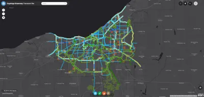
The current vision for the Cuyahoga Greenways is "a vast grid designed to connect the county's 59 communities to each other, to downtown Cleveland, the Lake Erie shoreline, the Towpath Trail in the Cuyahoga Valley, adjacent counties, and regions far beyond Northeast Ohio," explains Litt, encompassing "hundreds of miles of trails, greenways and bike paths."
The planning process is entering a public engagement phase, with a series of public hearings, listening sessions, and an online survey. "The public can also access a detailed online planning tool that enables users to zoom in on a highly detailed map of the proposed greenway network," according to Litt.
The article includes additional details about how the planning process has been funded, professional partners on the planning process, the original inspiration for the plan, and more about the broad ambitions the plan represents.
FULL STORY: Cuyahoga County seeks public input on greenways that would retrofit a region designed for the car

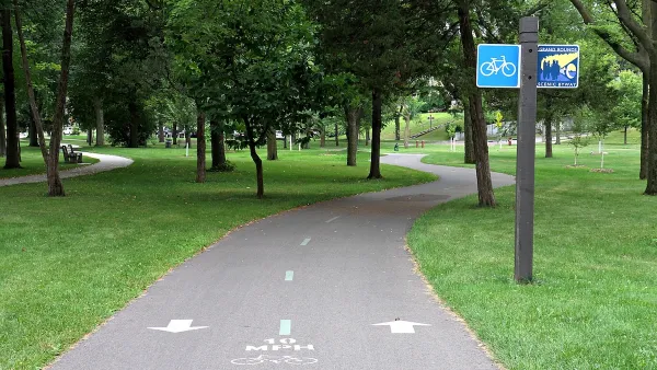
How to Make Greenways Better
Adding amenities such as public restrooms and shade trees can make greenways like Detroit’s Joe Louis Greenway more inviting and comfortable for their users.
Study: Cuyahoga County Suburbs Ready for TOD
The growth of transit-oriented development in the Cleveland region is being hindered by zoning codes that limit housing density and excessive parking requirements that drive up construction costs, new research suggests.
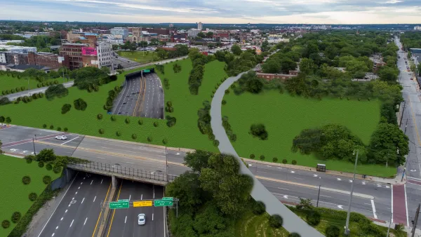
Freeway Cap Park Proposed in the Heart of Cleveland
A proposal to cap part of the Innerbelt Freeway east of Downtown Cleveland would require the demolition of a vacant, historic courthouse near the East 22nd Street Bridge.

National Parks Layoffs Will Cause Communities to Lose Billions
Thousands of essential park workers were laid off this week, just before the busy spring break season.

Retro-silient?: America’s First “Eco-burb,” The Woodlands Turns 50
A master-planned community north of Houston offers lessons on green infrastructure and resilient design, but falls short of its founder’s lofty affordability and walkability goals.

Delivering for America Plan Will Downgrade Mail Service in at Least 49.5 Percent of Zip Codes
Republican and Democrat lawmakers criticize the plan for its disproportionate negative impact on rural communities.

Test News Post 1
This is a summary

Test News Headline 46
Test for the image on the front page.

Balancing Bombs and Butterflies: How the National Guard Protects a Rare Species
The National Guard at Fort Indiantown Gap uses GIS technology and land management strategies to balance military training with conservation efforts, ensuring the survival of the rare eastern regal fritillary butterfly.
Urban Design for Planners 1: Software Tools
This six-course series explores essential urban design concepts using open source software and equips planners with the tools they need to participate fully in the urban design process.
Planning for Universal Design
Learn the tools for implementing Universal Design in planning regulations.
EMC Planning Group, Inc.
Planetizen
Planetizen
Mpact (formerly Rail~Volution)
Great Falls Development Authority, Inc.
HUDs Office of Policy Development and Research
NYU Wagner Graduate School of Public Service