


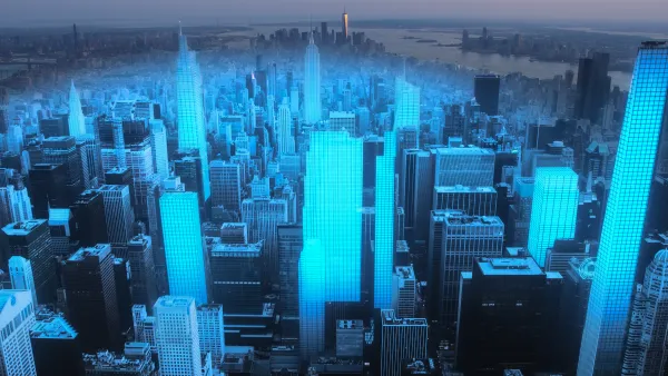
What's better than Twitter in the city? An iPhone. With a connection to the Internet, built-in camera, location-awareness, 3-access accelerometer and colorful display, the Apple iPhone has become much more than a mobile phone: it's a sophisticated mobile computing platform. Combine this technology with a library of thousands of programs and growing ecosystem of developers, the iPhone is powerful and versatile tool to transform how people interact with their surroundings. A growing number of iPhone apps are taking advantage of the phone's functionality to allow people to navigate, measure, observe, and interact with cities in new ways. This post describes some I have come across for e-government, urban sensing and interaction, and navigation. First, a caveat: I don't actually own one of the devices myself and haven't tested the apps (yet). I've certainly missed many, so leave your favorites in the comments below.

What's better than Twitter in the city? An iPhone. With a connection to the Internet, built-in camera, location-awareness, 3-access accelerometer and colorful display, the Apple iPhone has become much more than a mobile phone: it's a sophisticated mobile computing platform. Combine this technology with a library of thousands of programs and growing ecosystem of developers, the iPhone is powerful and versatile tool to transform how people interact with their surroundings.
A growing number of iPhone apps are taking advantage of the phone's functionality to allow people to navigate, measure, observe, and interact with cities in new ways. This post describes some I have come across for e-government, urban sensing and interaction, and navigation.
First, a caveat: I don't actually own one of the devices myself and haven't tested the apps (yet). I've certainly missed many, so leave your favorites in the comments below.
E-Government
A growing collection of apps allow city residents to report potholes, broken streetlights, graffiti, and other nuisances in need of fixing to government officials. The SeeClickFix site offers an iPhone app to report problems, however unlike the UK version the site doesn't automatically route the complaint to the proper authorities -- they must opt-in. Some tech-saavy governments subscribe, but most do not.
Ensuring your complaint reaches the proper ears requires a government-sponsored app. The winner of Washington, D.C.'s Apps for Democracy competition, 3*1*1 in DC, allows city residents to view and file service requests with the city's official 311 system.
Pittsburgh has launched a request app, called iBurgh. However, not everyone is thrilled, one reviewer left a one-star review in the Apple Store with a litany of complaints: "bad interaction flow through the app, incorrect use of the location API, no structured data in submissions, lack of visibility into your/all past entries, etc ... Needs work to be really useful."
The City of Boston announced the development of a similar app, called Citizen Connect, for Boston earlier this summer. Although I can't find it in the Apple Store, the company who developed the software for the city has some screenshots on their website. Perhaps someday soon we'll see these apps move beyond potholes to providing other services and perhaps even e-participation or e-democracy.
Urban Sensing & Interaction
A variety of apps allow iPhone owners to record their surroundings, explore digital information about urban spaces, and network with others in new ways.
Widenoise lets users upload sound samples for various places, categorizing them according to how noisy they are. Read Write Web speculates it could be a tool to research a neighborhood before buying a house, only one of the potential uses. Another? Cataloguing a nuisance neighbor or noisy construction site.
On the topic of posting information, the Fwix real time news app hopes to encourage citizens become journalists, uploading news as it happens to their localized news website. Find 140-character tweets too limiting for your civic feedback? Post news reports from the public meeting in real time with this app.
Flickup lets people upload geotagged photos, and other image-related apps could have urban applications. The Digital Urban blog posted a tutorial on how to use an iPhone app to create a time lapse film of an urban skyline.
Of course, most users are interested in practical information. Look up reviews of nearby businesses with the Yelp app, or investigate whether any registered sex offenders live nearby using the Offender Locator Lite. DGRadar searches for "pictures, articles about well-known landmarks from wikipedia, or information and reviews of restaurants."
The Navizon app allows you to track the location of your friends. Despite the good concept, it got poor reviews in the Apple App store. Loopt allows you to do the same, and has just negotiated a deal with AT&T to let their application track your location even when the app is closed.
The foursquare app lets you "check in" from places you visit and interact with the Foursquare website. Back in April I heard Tim Hwang suggest at a conference the website's practice of naming people "mayors" of wherever they check in the most could be leveraged for some form of social good.
Finally, a new application from Metaio allows users to "leave tweets, messages, web pages and 3D models in a real space for other users to view or pick up when there are in the vicinity." This app is part of the emerging field of augmented reality tools, which overlay additional information on images of the real world.
In fact, the Yelp app has this functionality built in. Once this technology has advanced further it could have tremendous application in urban visualization. Imagine a tool that let you point your iPhone at a vacant lot, and then you can cycle through various renderings: demolished former building(s), hypothetical renderings from city plans, developers' proposals, and even potentially student or citizen-created proposals. Someday citizens may be able to mark up a life-sized virtual 3-D model of a proposed development with citizen comments by visiting the site, and peering through the iPhone screen.
Navigation
Finally, but certainly not least, a host of iPhone apps are designed to assist users of nearly every major transit system. San Francisco's BART and Portland, Oregon's TriMet even have pages listing all relevant apps.
A company called Discover Anywhere Mobile is waiting for Apple to approve their Discover Anywhere Transit app, which contains detailed listing of transit stops and even an "Augmented Reality" mode with information shown above the camera image. Even more provocative is an idea I heard advanced by Karen Quinn Fung, who helped organize Vancouver Transit Camp. She suggested transit users participate in improving transit systems and helping to manage service. Some of the ideas we discussed included using rider's phones to report back real-time data about whether buses are running on time, apps to let the public provide input on improving stations, stops, and other operational details, and even help tools to match service to demand through crowdsourcing operations.
Of course, if you get bored with your city you can always boot up the Planetizen app to find out what's happening elsewhere. What are your favorite apps?

Using Web Mapping For the Public Good
The use of geographic information systems for the public good is a rapidly growing field. The technology shows great promise for discovering unequal distribution of resources and environmental racism, writes Peter Manzo.
4 Ways to Use AI in Urban Planning and City Design
With the ability to predict trends, engage citizens, enhance resource allocation, and guide decision-making, artificial intelligence has the potential to serve as planners’ very own multi-tool.
Location Data Could Unlock a Less Car-Centric Future
A report from the Brookings Institution shows how planners can use new types of anonymized data to inform mobility planning decisions.

National Parks Layoffs Will Cause Communities to Lose Billions
Thousands of essential park workers were laid off this week, just before the busy spring break season.

Retro-silient?: America’s First “Eco-burb,” The Woodlands Turns 50
A master-planned community north of Houston offers lessons on green infrastructure and resilient design, but falls short of its founder’s lofty affordability and walkability goals.

Delivering for America Plan Will Downgrade Mail Service in at Least 49.5 Percent of Zip Codes
Republican and Democrat lawmakers criticize the plan for its disproportionate negative impact on rural communities.

Test News Post 1
This is a summary

Test News Headline 46
Test for the image on the front page.

Balancing Bombs and Butterflies: How the National Guard Protects a Rare Species
The National Guard at Fort Indiantown Gap uses GIS technology and land management strategies to balance military training with conservation efforts, ensuring the survival of the rare eastern regal fritillary butterfly.
Urban Design for Planners 1: Software Tools
This six-course series explores essential urban design concepts using open source software and equips planners with the tools they need to participate fully in the urban design process.
Planning for Universal Design
Learn the tools for implementing Universal Design in planning regulations.
EMC Planning Group, Inc.
Planetizen
Planetizen
Mpact (formerly Rail~Volution)
Great Falls Development Authority, Inc.
HUDs Office of Policy Development and Research
NYU Wagner Graduate School of Public Service